Meta and World Resources Institute Release High-Resolution Global Map of Tree Canopy Height
AI Maps Forests in Detail to Combat Climate Change
Forests are critical for our planet’s health, but monitoring their well-being has always been a challenge. Now, Meta and World Resources Institute (WRI) are tackling this issue with high-tech maps.
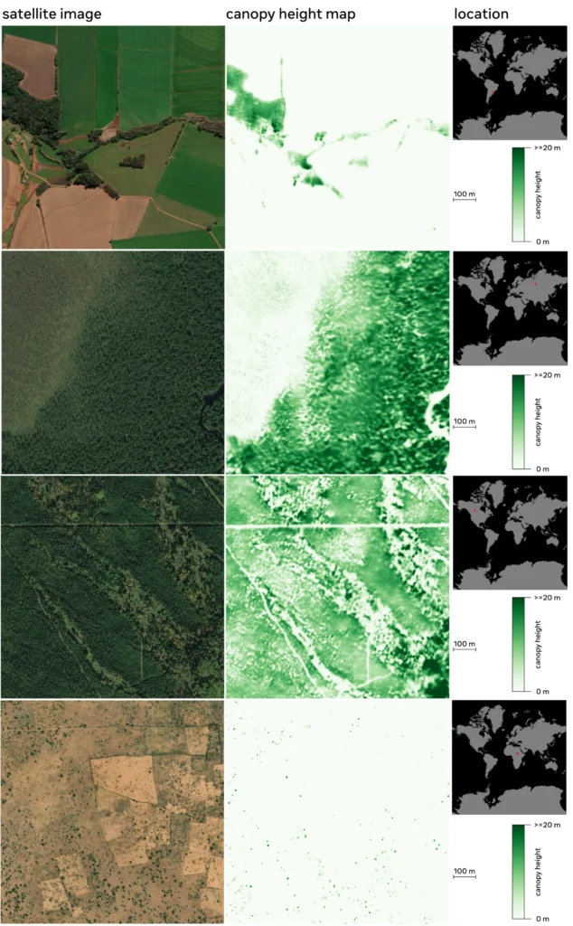
The key to their solution is artificial intelligence (AI). They’ve developed AI-powered maps that can zoom in to individual trees, thanks to a staggering 1-meter resolution. This allows them to track even small changes in forest canopies, something older methods struggled with.
These detailed maps are a game-changer for monitoring forest health. They can be used to improve the accuracy of forest-based carbon credits, a crucial tool in the fight against climate change. Additionally, conservation and restoration efforts will benefit greatly from this new ability to precisely track progress.
But Meta and WRI aren’t keeping this technology to themselves. They’ve made the data and the AI models behind the maps freely available. This allows anyone to build upon their work, further accelerating innovation in forest monitoring.
The impact of this project is potentially huge. By making forest measurement more accurate and transparent, it can lead to better protection of our natural world and a more effective fight against climate change. This is a significant step forward, and it paves the way for even more exciting developments in the future.
Meta and World Resources Institute Release High-Resolution Global Map of Tree Canopy Height
Why it Matters:
- Accurate forest monitoring is crucial for tackling climate change.
- Existing methods struggle with details like young trees or small projects.
The Solution:
- Meta and WRI developed AI-powered maps with 1-meter resolution.
- This allows detection of individual trees and small changes in canopy height.
Benefits:
- Improves monitoring of forest-based carbon credits.
- Enables better tracking of conservation and restoration efforts.
- Freely available data and models for further development.
Technical Details:
- Leverages high-resolution satellite imagery and DiNOv2 AI model.
- Trained on massive datasets for global accuracy (1 trillion pixels).
- Predicts canopy height with 2.8-meter average error.
Applications:
- Establishing baselines for conservation projects.
- Monitoring progress of initiatives like TerraFund for AFR100.
- Rewarding successful projects and identifying those needing support.
Impact:
- Improves transparency and accountability in the carbon market.
- Enables better protection of biodiversity and climate change mitigation.
- Opens doors for further innovation in forest monitoring.
Image Source & Reference: https://sustainability.fb.com/blog/2024/04/22/using-artificial-intelligence-to-map-the-earths-forests/