ForestSAT
Dam Observatory ©

CONTINUAL ASYNCHRONOUS
DAM MONITORING & AI CLIMATE
RISK MODELLING

CLIMATE CHANGE
CHALLENGES TO DAMS

Climate change is putting enormous sudden pressures on Dams due to global warming, changing rain patterns, glacial melting, cloudbursts and resulting flash floods & landslides which causes unseasonal flows of silt and debris at catastrophic speeds and volumes into the dams and rivers.

ForestSAT Dam Observatory is first of its kind continual, real-time, asynchronous project level highly precise and accurate monitoring of multiple aspects of dam ecosystems . Satellite and sensor data is continually analyzed – from glaciers and glacial lakes; from weather predictions and cloudbursts to water levels; and from landslides to subsidence by custom developed Artificial Intelligence Algorithms taking human factor and imprecision out of equation. 

Providing Risk Assessment and Warnings for Disaster Prevention

As Glaciers Melt , High Altitude Lakes Grow
Causing Unseasonal Flash Floods with Debri

Moraine-dammed glacier lakes in the Himalayas. (A) Distribution of moraine-dammed lakes in our study region in 1° × 1° bins. Bubbles are scaled to the total lake area, and color-coded to abundance. Reported GLOFs (yellow triangles) have occurred most frequently in the past 8 decades in regions where glacier lakes are largest. (B) Location of the Himalayas between the Indian subcontinent and the Tibetan Plateau. (C) Histogram of glacier lake areas. Ref: Hazard from Himalayan glacier lake outburst floods | PNAS

Interferometric Dashboards

Monitoring Subsidence
Ground subsidence from a variety of causes has been successfully measured using InSAR. InSAR is an indispensable tool to minitor subsidence.

Monitoring Landslides
Detection and monitoring of landslides in vast mountainous landscapes.

Ice flow
Continual monitoring of glacial motion and deformation including remote, high-resolution measurement of changes in glacial structure, ice flow, and shifts in ice dynamics.

ForestSAT  Artificial Intelligence for forecasting, decision support & actionable intelligence is developed in collaboration with engineers, dam structural and safety experts, glaciology, hydrology, and metrological experts.

ForestSAT Interferometry & Dam Observatory© Satellite and ground sensors data continually analyzed to deliver reports and alerts on dashboard & mobile apps to all stakeholders creating situational awareness for risk mitigation and disaster management.

Accurate real-time insights & data-driven Decision Support.

Asynchronous Automatic Monitoring:

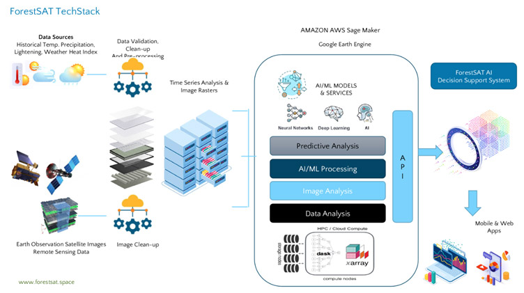
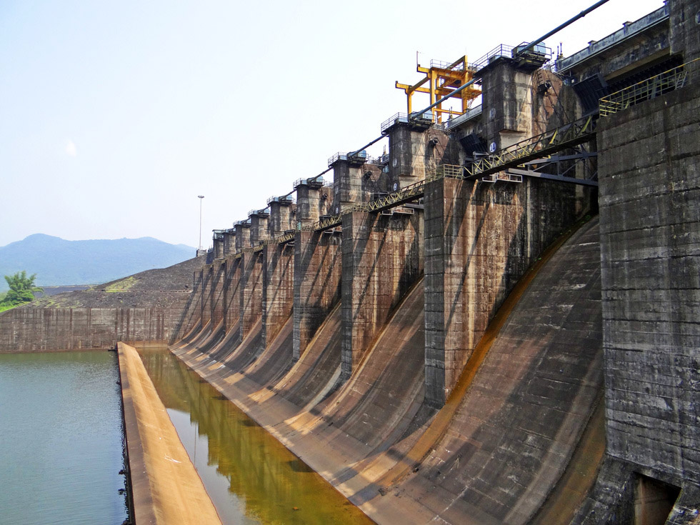
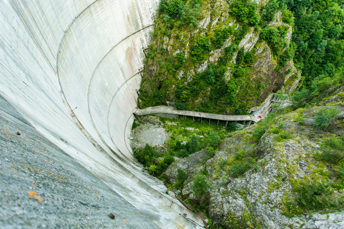
Monitor your dam & infrastructure 24/7 and track any changes, movements, leakages or
severe weather conditions using advance satellite data, satellite based imagery and IoT
sensors.

Analyze:

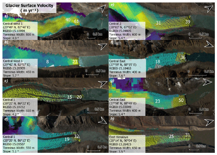
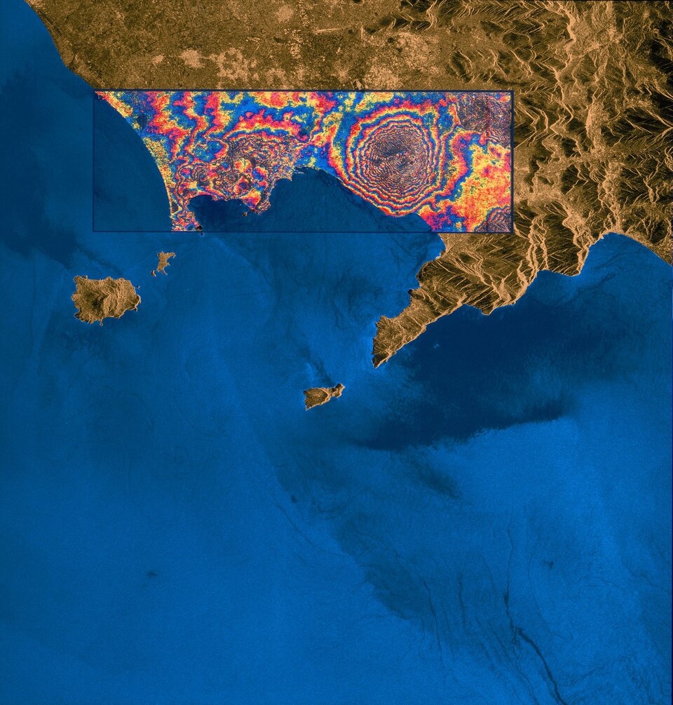
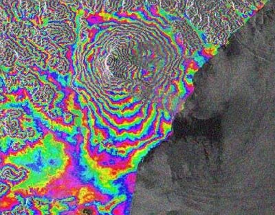
Automatically analyze changes via time series analysis and Machine Learning
algorithms to detect the smallest of changes.

Understand:

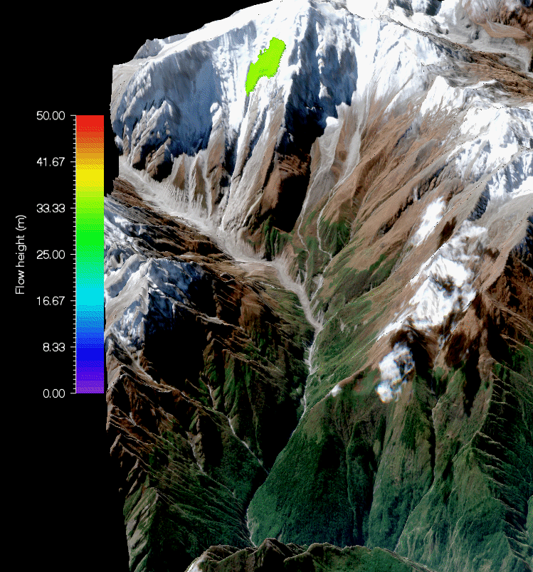
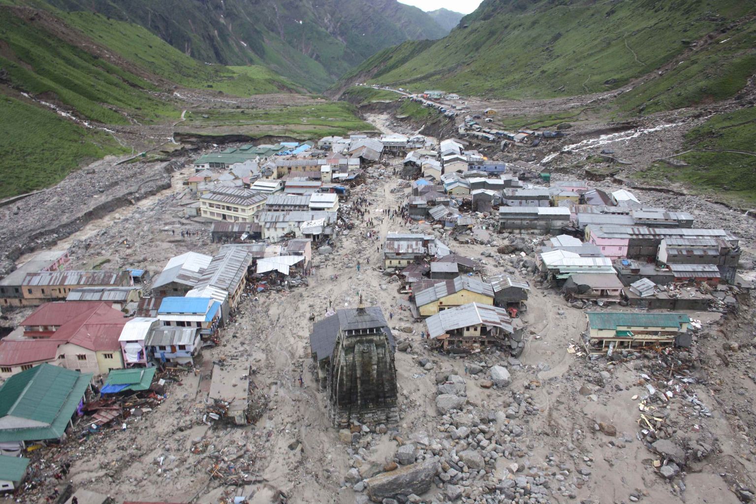
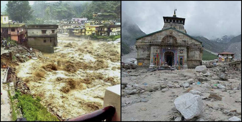
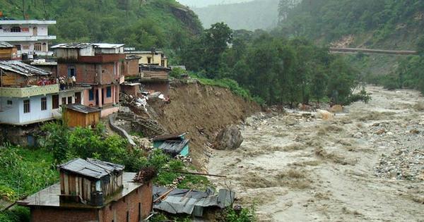
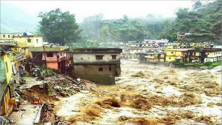
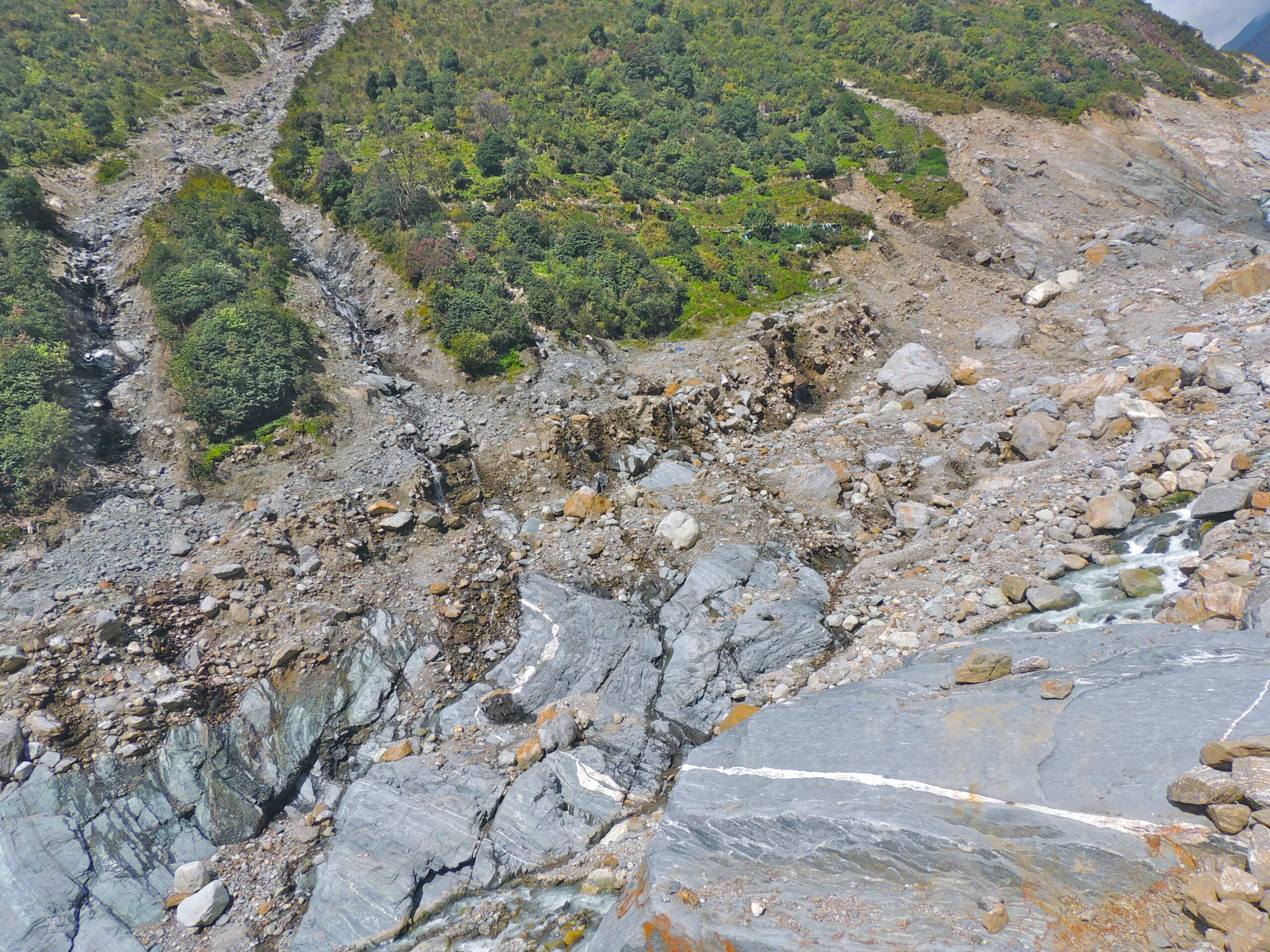
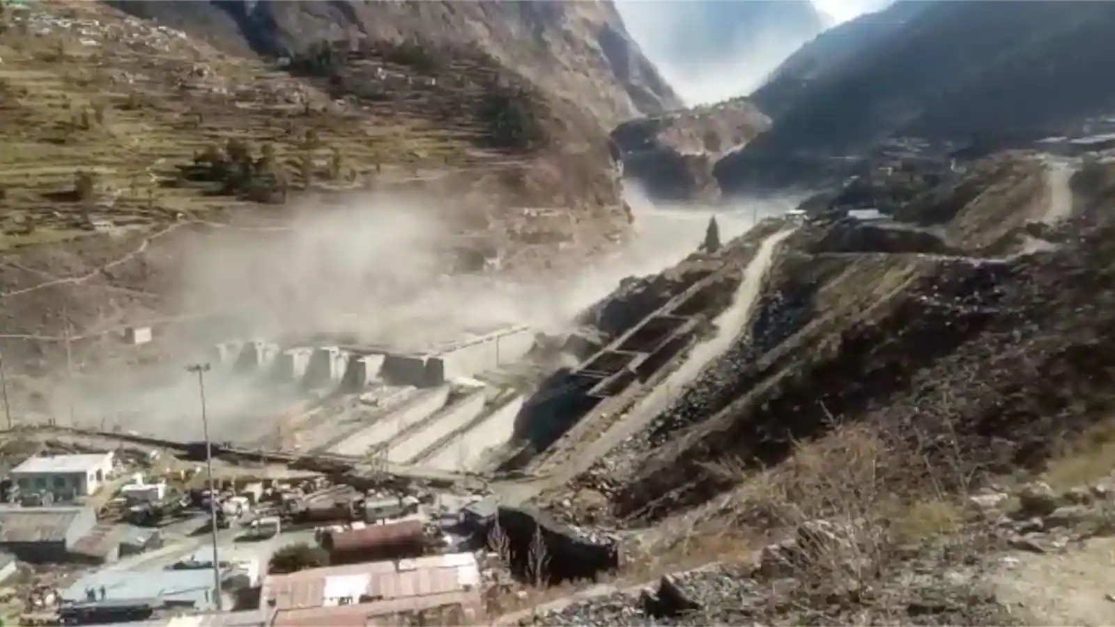
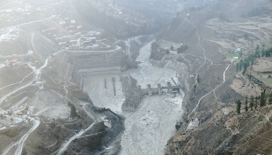
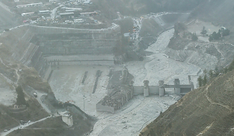
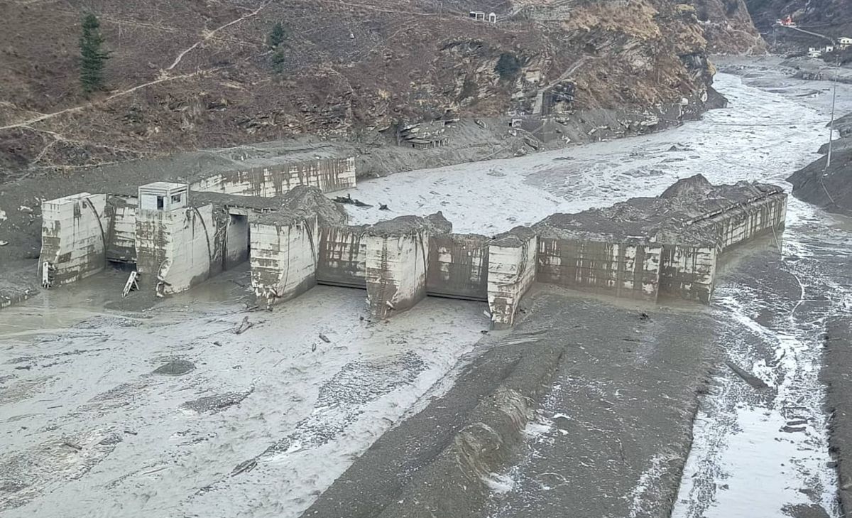
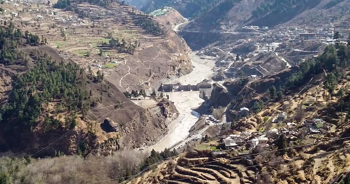
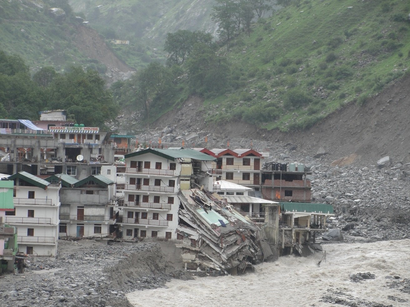
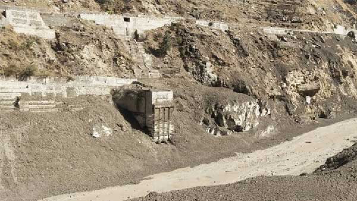
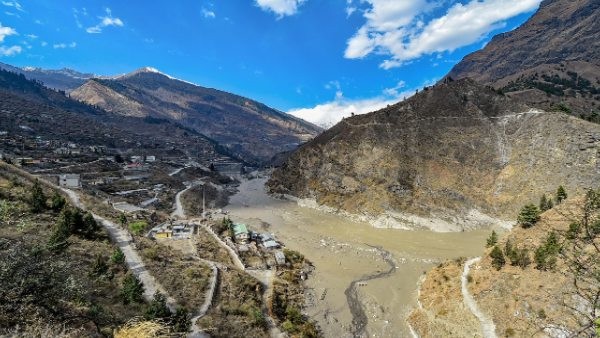
Instant understanding of impact of sudden changes and events in the whole ecosystem such
as cloudbursts, landslides, glacial breaks, lake breaches and multiple parameters via our
machine learning models.

Instant Process:

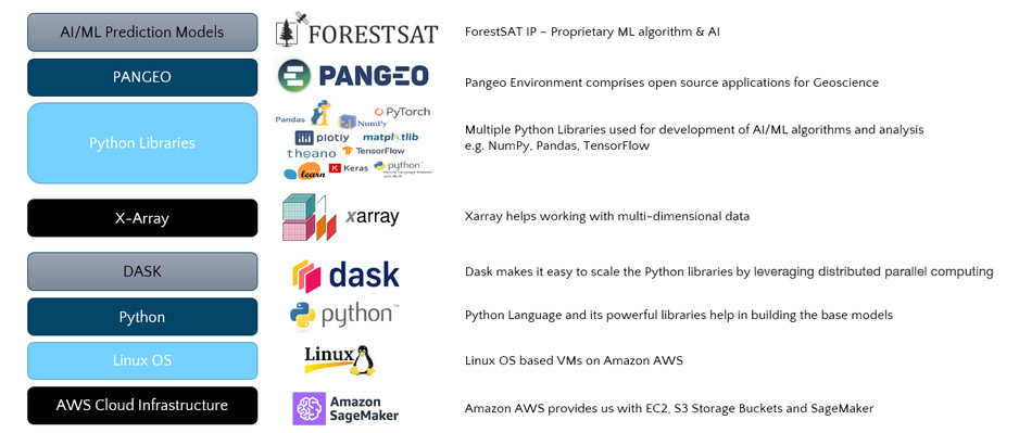
Petabytes of incoming data is instantly processed on powerful cloud servers through custom built algorithms.

Predict:

Our predictive models help in analyzing various sources of data and provide prediction of
affect of sudden warming, high rainfall, shifts in weather conditions at high remote altitudes
and other parameters.

Assess:

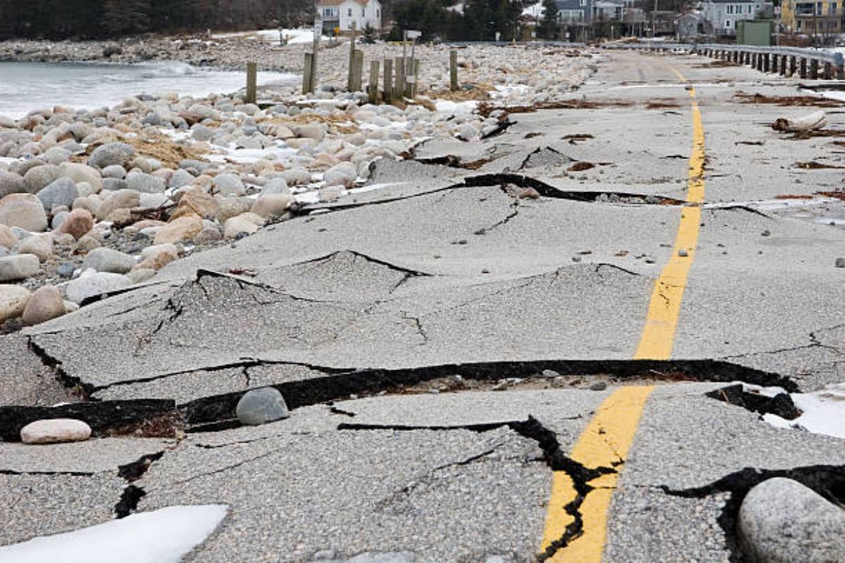
The solution helps in assessing the risks via various parameters and modules on a real-time and
continuous basis. Early identification of risks is matched with preexisting risk-models by our AI
and enables stakeholders to assess the impact of developing risks and threats and take timely
action on the alerts.

Decision Support System (DSS):

The solution keeps on continually monitoring all relevant parameters and infrastructure and
delivers actionable intelligence in the form of a Decision Support System, that enables
stakeholders at all levels from local to policy level to take timely action, monitor and assess the outcome.

Reduce Risk:

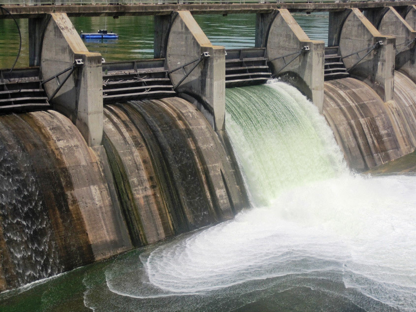
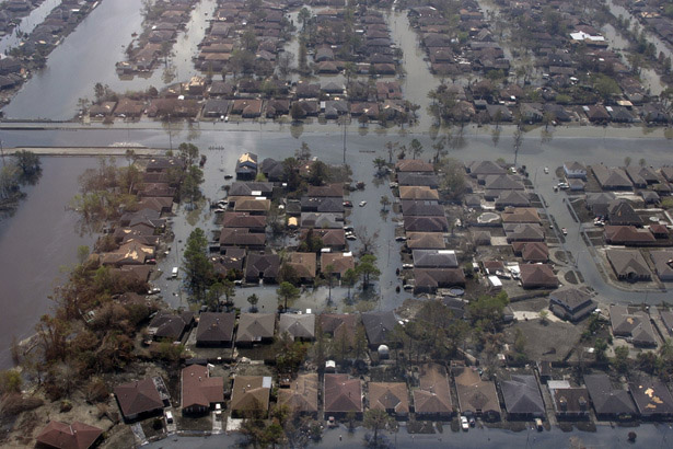
Risk reduction measures can be implemented by any entity that may be affected by or is at
risk from a dam failure, including state, local, and tribal governments; communities; dam
owners and operators; and individual property and business owners.

ForestSAT Tech Stack

Earth Observation
Risk & Hazard Monitoring & Modeling

Our solution obtains historical and asynchrochous data from a dozen satellites as required.

Our AI processes multiple Satellite Optical Imagery, Synthetic Aperture Radar (InSAR), Multispectral and Hyperspectral data  along with in-site ground sensor data. 

Satellites

  • MODIS  Terra
  • GOES-16/17
  • GeoEye
  • WorldView 1,2,3,4
  • Ikonos
  • BSAT-4b
  • QuickBird
  • Doves, SkySat and RapidEye
  • Capella
  • ICEYE X1,X2,X3,
  • Landsat – 7,8,9
  • MetOp
  • NOAA
  • Pleiades Neo, Pleiades 1a/1b
  • Vision-1
  • Radar & DMC Constellation
  • SPOT 6/7
  • Sentinel 1A, B
  • Sentinel 2A, B, C
  • Sentinel 3A

Multispectral optical sensors and Radar allow satellites to see more. Optical sensors detect a broader range of wavelengths. Satellites with radar sensors measure the height of objects with an accuracy of millimeters and thus enable our AI to perform “change analysis” and “time series analysis” automatically, continually over very large areas with great accuracy and detect subsidence, cracks and other changes.

Automated, daily updates on multiple factors and parameters in remotest inaccessible areas with accuracy using remote sensing satellites. We work with multiple satellite images – we use multispectral, radar, and LiDAR data with cm level accuracy. The data is analysed continually with our  Artificial Intelligence built in close collaboration with engineers and management so as to infuse several man years of knowledge into AI, while analysing enormous amounts of data (many years of knowledge is built in to analyse petabytes of data within minutes)

We build our AI by accessing multiple years of weekly archives of historical satellite data to perform time series analysis on large areas to identify trends and identify patterns and anomalies. This is the foundation stone of our AI which is made predictive and generative as more data is trained into the machine learning algorithms after appropriate annotations and interpretations provided by specialist engineers of the project.

For optimal functioning, critical data is measured from the source of rivers – glaciers, glacial lakes, and mountain reservoirs to model potential threats of flash floods to river tributaries, dam catchment areas and further downstream

Reference: https://www.rgs.org/geography/geovisualisation/chamoli-avalanches/
Dr Anshuman Bhardwaj and Dr Lydia Sam (both University of Aberdeen) created this visualisation of earth observation data to visualise and help understand avalanches in Chamoli district in the Indian Himalayas.

Predictive maintenance is the key to preventing structural problems. This requires continual monitoring with high precision and modelling multiple outcomes based on data modelling which is in turn built on available historical data and continual incoming data which must be analyzed instantly, and automatically. The human factor risk in failing to spot trends or problems must be eliminated and hence AI plays a crucial role in dam , reservoir and river safety.

Monitor Multiple Factors & Assess Risks Continually

Independent and objective risk evaluation needs to be continuously completed in order to support local operators, in case of any irregular surface and related object motion to avoid serious incidents occurring due to:

Dam infrastructure integrity and safety

Retaining Walls

Dam Leakages

Glacier Lakes

Breakup of Glaciers

Heavy Rainfall & Storms

Cloud Bursts

Flash flood scenarios

Contact us now to discuss how we can enhance your risk awareness and risk management.

ForestSAT AS, Norway
www.forestsat.space
comms@forestsat.space
WhatsApp: +47 - 786 74 335