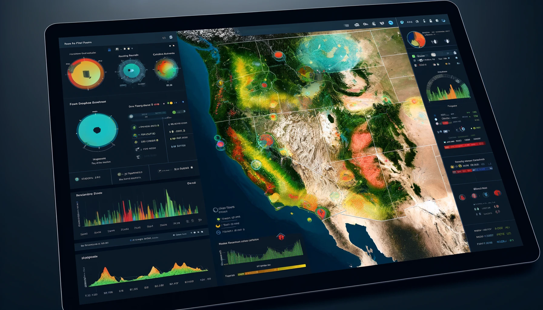
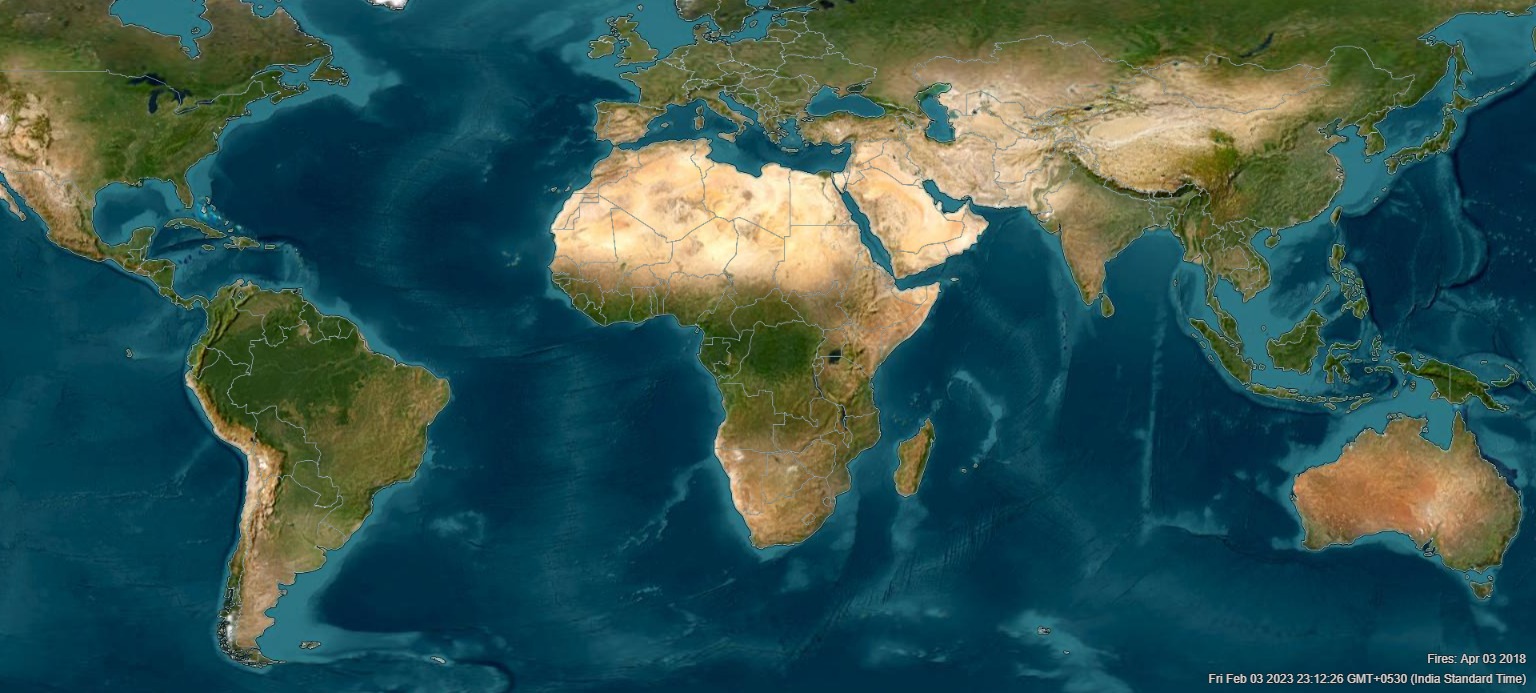
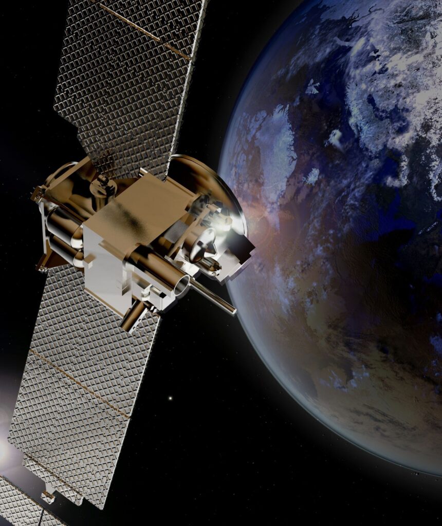
Satellite Earth Observation
Forest Fire Prevention
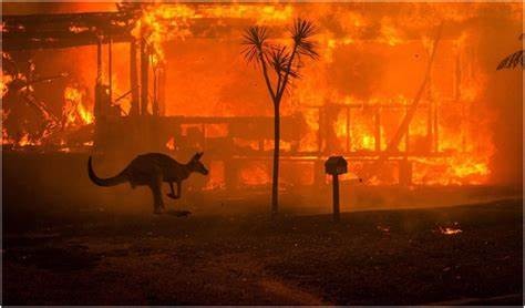
Animal species, Flora and Fauna is going extinct because of wildfires.
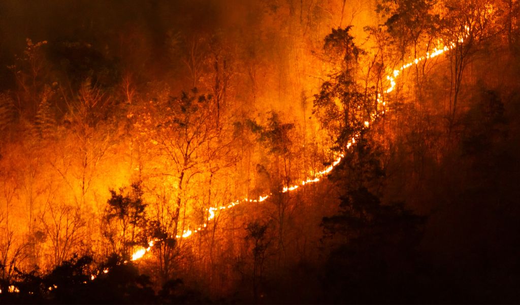
Wildfires are intensifying since the turn of century and each year is seeing a record area burned.
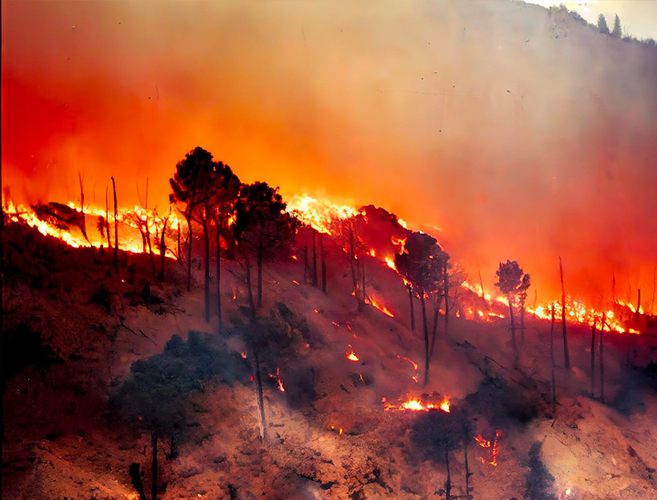
Wildfires are intensifying due to global warming and in turn contribute to climate change and extreme temperatures.
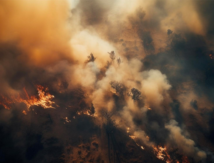
Smoke from forest fires travels across continents damaging air quality causing health problems.
ForestSAT.space Decision Support System (DSS) based on Satellite Earth Observation EO Data & AI
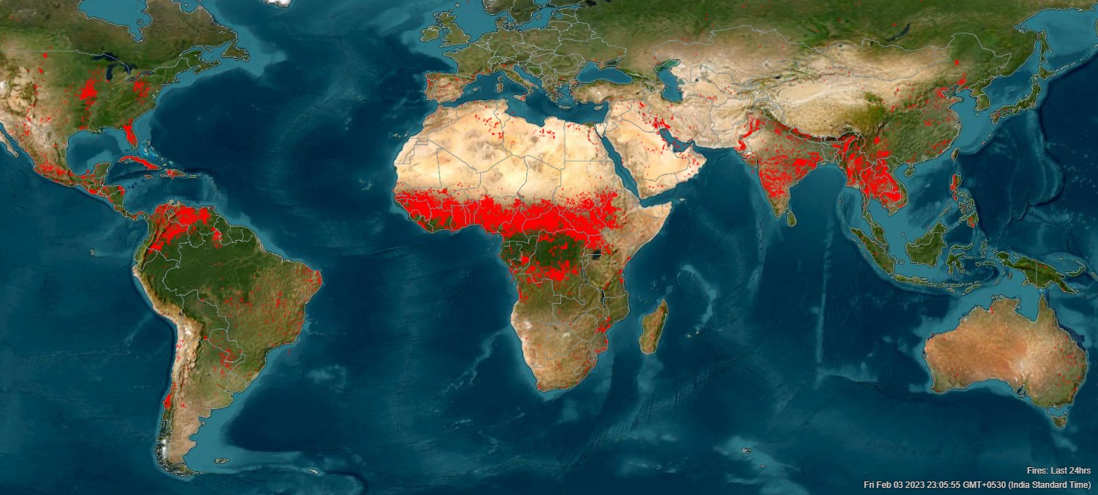
We are leveraging satellite earth observation data and artificial intelligence (AI) to predict and prevent large forest fires that are devastating our planet’s forests and animal life with increasing frequency and ferocity due to climate change induced stresses and extremities.

Forest fires and degradation are directly responsible for more greenhouse gas emissions than the US, Germany, UK, Italy and France combined.

9 out of 10 forest fires are started by humans. ForestSAT App brings satellite data to communities informing and engaging toward preventive action. Get this app for your community now -
ForestSAT.space DSS Fire Prevention as a Solution for Forest managers is a Satellite data & AI driven Decision Support System (DSS) for smart, strategic, timely and precise forest fuel management & forest regeneration to reduce or eliminate mega fire risk pre-season.
Actionable knowledge based on petabytes of data is delivered through an interactive, intuitive browser based solution without the need for any specialized software or skills to forest front line workers, fire fighters, community leaders, policy makers and financiers.

Absolutely Free Advisory: Access nature carbon finance to mitigate the risk of uncontrolled large wildfires and embark on a journey to bring resilience to your wildlands.
Founder, CEO
Ajay is a passionate environmentalist and a serial entrepneur and has created media, dotcom and tech enabled finance companies in 6 countries in the last 25 years since graduating as an Engineer from National Institute of Technology India. Ajay created the first European yoga-meditation-ogranic themed net-zero resort hotel ZENING in Cyprus.
Chief Technology Officer
Bhaskar is tech entrepreneur with 20 years of experience leading a team of 40 developers in AI/ML and has developed Apps, ERP software for Banks, e-commerce, and communication sectors. He has built tech that powers eWallets & Money Transfer for 60+ Banks across Globe. Bhaskar is a Blockchain enthusiast and has a Master’s Degree from Mumbai University and Diploma in Data Science & AI/ML Specialization from EICT Academy, Indian Institute of Technology and PGP in AIML from UT Austin Texas, McCombs School of Business.
Aerospace Engineer & Data Scientist
Veronika is an aerospace engineer from Moscow Aviation University and has worked in Sukhoi 5th Generation Fighter jet design bureau and a team leader at Accenture in data management leading a team of over 80 programmers and data scientists. She is a nature lover and a leading yoga teacher of the world.
GIS Specialist
My name is Ayush Kumar, and I am a GIS Specialist at FORESTSAT. I apply my extensive background in geospatial technologies to advance the organization’s environmental and research objectives. I hold a Master’s degree in Geoinformatics from TERI School of Advanced Studies. I am proficient in ArcGIS Pro, QGIS, Google Earth Engine, and Python-based geospatial libraries such as Rasterio, GDAL, and GeoPandas.
In my role at FORESTSAT, I develop and implement geospatial workflows, create analytical dashboards, and convert complex datasets into actionable insights. I also take on key management responsibilities, including overseeing team operations, coordinating project tasks, and ensuring timely, high-quality project delivery. I am committed to working towards creating innovative remote sensing and GIS-based solutions that can provide real-time, practical value across environmental and operational applications.
I am fluent in Hindi, English, and Telugu, enabling me to communicate effectively within diverse team settings. Outside of work, I enjoy trekking and outdoor sports—activities that strengthen my connection to the natural environment and fuel my passion for environmental and geospatial research.
GIS Professional
I am Ritik Singh, a dedicated GIS professional with a strong foundation in geospatial technologies and data-driven problem-solving. I completed my Post-Graduation in M.Sc. Geoinformatics from the TERI School of Advanced Studies, New Delhi, and my Graduation from Shaheed Bhagat Singh Evening College, University of Delhi. Today, I am proud to contribute my skills and expertise as part of ForestSAT AS, where I work on geospatial analysis, remote sensing applications, and environmental insights.
Throughout my journey, I’ve developed hands-on experience with various tools, including ArcGIS, ERDAS IMAGINE, QGIS, Google Earth Engine, and Botsol, as well as strong capabilities in Remote Sensing and GIS-based modelling. I have worked on a pan-India data development project with CBRE, creating large-scale geospatial datasets, and I have also been associated with AGAAZ, an organisation committed to educating underprivileged children—an experience that strengthened my purpose beyond professional work.
Outside my professional life, I am passionate about travelling, adventure, and sportsmanship, believing that exploration and discipline shape both personal and professional growth. My goal is to continue evolving as a GIS specialist while contributing meaningfully to projects that create real-world impact.
GIS and WebGIS Developer
I am Deepak Kumar Pradhan, a GIS and WebGIS Developer with a strong foundation in geospatial technologies, spatial analysis, and full-stack WebGIS development. With technical expertise across ArcGIS, QGIS, ERDAS Imagine, MATLAB, OpenGrADS, Google Earth Engine, and modern web technologies (HTML, CSS, JavaScript), I specialize in building scalable, intuitive, and efficient geospatial platforms and applications. My work revolves around transforming complex datasets into meaningful, interactive mapping solutions that support decision-making and real-world applications.
A graduate of Calicut University with a B.Sc. in Geography and an M.Sc. in Geoinformatics from the TERI School of Advanced Studies, I’ve developed a strong academic and practical foundation in geospatial science, cloud computing, data interpretation, and model-driven analysis.
Currently, I am working at ForestSatAS, where I contribute to the development of advanced WebGIS platforms—integrating spatial analytics, modern UI frameworks, and cloud-based geospatial workflows to create powerful mapping solutions.
Outside of work, I’m passionate about traveling, riding, playing outdoor sports, and writing—from novels and books to song lyrics. My goal is to continue growing as a geospatial technologist, building impactful geospatial systems, and contributing to innovative, data-driven solutions that make a real difference.
GIS Professional
I am Osheen, a GIS Professional at ForestSAT AS with a background in spatial data analysis and remote sensing. A graduate of the TERI School of Advanced Studies, New Delhi, I have a strong academic foundation in using spatial data to derive meaningful insights and am confident working with research methods and modern GIS software.
At ForestSAT AS, I focus on large-scale wildfire risk analytics, building machine learning–based fire susceptibility models, creating detailed maps and visualizations, and preparing decision-support reports using ArcGIS, QGIS and Python.
I enjoy travelling, discovering new places, and finding inspiration in everyday landscapes. I also enjoy reading, which helps me unwind and stay curious. I am committed to growing both professionally and personally, building meaningful collaborations, and contributing positively wherever I can.
GIS Professional
I am Mrityunjay Sharma a GIS professional with expertise in spatial data analysis, remote sensing, and geospatial solutions. I graduated from the TERI School of Advanced Studies, New Delhi, and currently work at ForestSAT AS, where I contribute to developing data-driven environmental insights and decision-support tools.
I’m passionate about creating innovative GIS-based solutions to address modern-day challenges, with sustainability at the core of my work. I believe in continuous learning, adding meaningful value through every project, and driving positive change through geospatial technology.
GIS and Sustainability Professional
I am Nikhar Pathania, a GIS and Sustainability Professional with a postgraduate degree from the TERI School of Advanced Studies, New Delhi. My academic background and field experience have equipped me with a strong understanding of environmental systems, geospatial analysis, and data-driven sustainability approaches.
My skill set includes spatial analysis, remote sensing, Google Earth Engine, GIS software, multi layer data processing , and sustainability-focused research. I specialize in interpreting environmental parameters, conducting geospatial assessments, and preparing comprehensive analytical reports that support informed decision-making. I enjoy working at the intersection of technology and sustainability to convert complex data into meaningful insights for environmental management.
Beyond my professional work, I am passionate about yoga, sports, and contributing to initiatives that enhance community well-being and strengthen environmental conservation. I am committed to continuous learning and to creating positive impact through meaningful, sustainability-focused work.